
Sunday, February 26, 2012
I never
thought for a moment that we could really be that far out of shape,
especially me. I work in a physically demanding job and am otherwise
active throughout the week. I am not overweight at all. Despite all
this, Jakob and I nearly died of exhaustion today while climbing
Kwaaypaay, the smallest of
the five peaks in Mission Trails Regional Park. Okay, it wasn't that
bad, but by the way Jakob and I were sucking wind, you'd have sworn
we just ran a full marathon.

We started
out by parking the truck on Friar Junipero Serra Mission Gorge Trail.
The parking
lot at Padre dam and the one across from Kumeyaay Lake Campground on
Bushy Hill Drive were both packed full, as was both sides of the
street all the way up from the dam to well past the Campground turn
off, so we parked almost all the way up by Mission Gorge Rd. If I
ever go hiking in Mission Trails again, it will most definitely not
be on a weekend. Mission Trails regional park marks the end of the
city of San Diego to the east and contains five of the highest points
in the entire city, visible from most anywhere in San Diego. It is a
well established, maintained, patrolled, and most importantly, funded
trail system and park which includes plenty of history, a campground,
a lake, and, as I said, five of the highest peaks in the city of San
Diego.

Climbing
Kwaaypaay was the first in our Summits Series. When I asked the boys
what their goals were with regards to climbing, they said that they
wanted to climb Everest by the age of twenty. Such a lofty goal
requires years of preparation and training, building up to something
so huge. So I asked them how they planned on attaining that goal,
what steps they were going to take. After looking at local nearby
mountains as a starting place, we discovered The San Diego 12,
the twelve highest peaks in the city of San Diego. Now out of these
twelve, three are not climbable, plus if you're going to climb Cowles
Mountain, you might as well continue on to Pyles Peak since they
share the same trail, and the same can be said of Mt Fortuna's North
and South Peaks, so I guess that leaves us with The San Diego 7. Take
a look at the list below...
San
Diego City 12
1. Cowles
Mountain 1593' / Pyles Peak 1379'
2. Black
Mountain 1556'
3. Mt
Fortuna, North Peak 1291' / South Face 1094'
4.
Kwaaypaay 1195'
5. Mount
San Dieguito 1118'
X.
Lake Murray Mountain 851' (Not climbable because a neighborhood is
built on top of it and
the Summit is in the dining room of
5158 Overlake Ave in Del
Cerro =)
6. Miramar
Hill 840'
X.
Mt Soledad 808' (Not climbable because a neighborhood is built on top
of it.)
7. Torrey
Highlands 432'
X.
Cabrillo 423' (Not climbable because there is a National Monument
built on top of it and a
military base surrounding it.)
It
was decided that we would start by climbing the toughest mountains in
our city, then make a list of the toughest mountains in our County
(we discovered there are eighteen that we would like to climb). We
would then move on to chose seven mountains in our Region (Southern
California), which includes such giants as Mt San Gorgonio and Mt San
Jacinto, and finally we would select seven challenging summits in
North America (The boys have thus far been eying Whitney, Elbert,
Rainier, and Hood, with an eye toward something in the Black Hills or
Appalachians and a couple 16-18k beasts in Alaska. Only then, they
say, will we move on to the seven summits, the highest mountain on
each continent, ending, of course, with Everest. I pointed out, of
course, that we must find some way to become independently wealthy
and not have to work anymore before any of this will happen. I don't
know if I should be a little bit frightened that the boys think they
have the solution to this problem, but won't tell me about it.
Anyway, its a good goal, though I doubt if they'll ever make it all
the way due to lack of funding, but the least I can do is help them
get as far as they can with what we have. This means climbing
Kwaaypaay today.
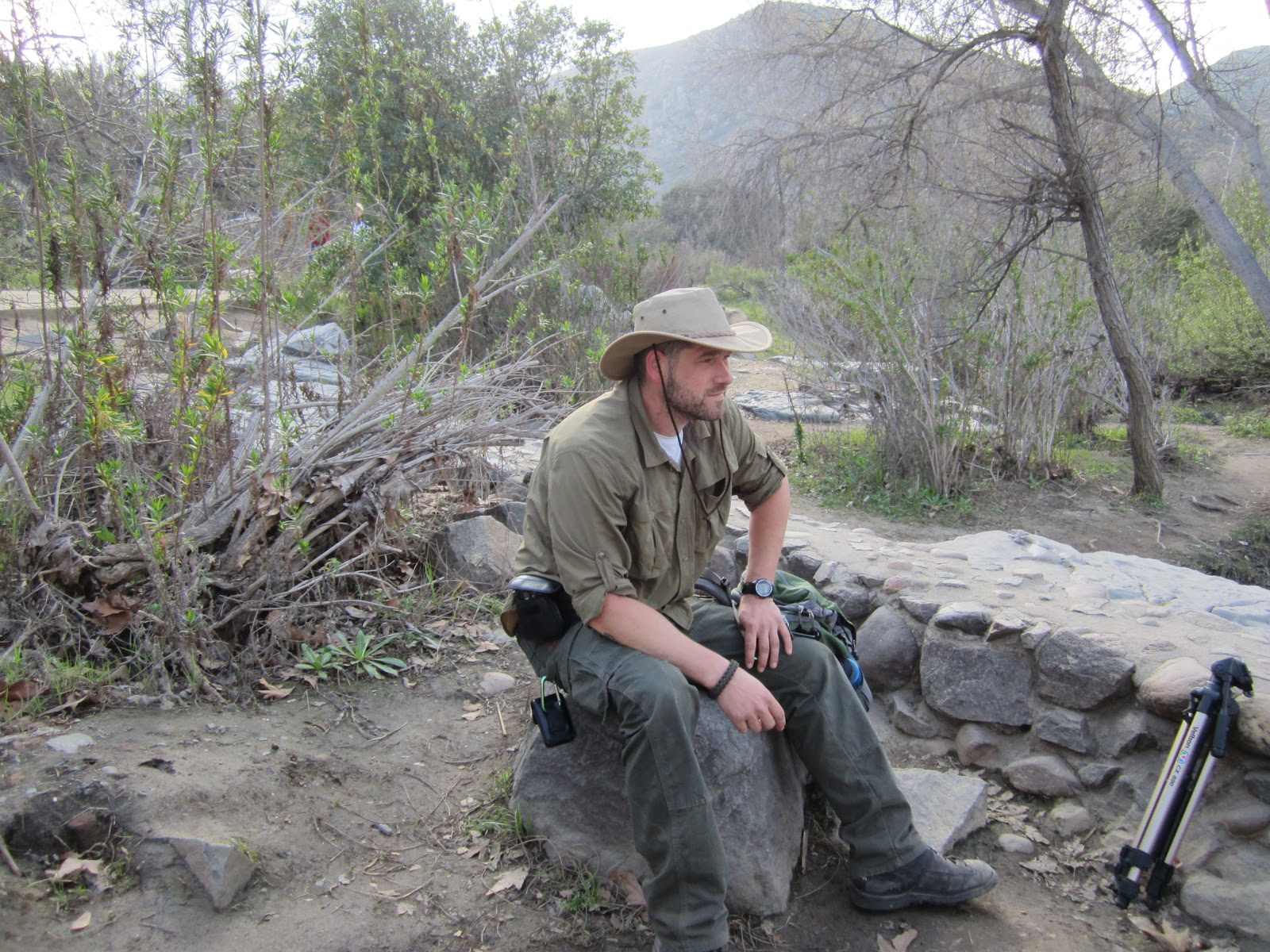
Joshua
decided that he didn't want to hike this week and so Jake and I hit
the trail, just the two of us. Turning off the Friar Junipero Serra
Trail, we were immediately confronted with our first challenge.
Kwaaypaay's first hill is pretty steep, and it's just out there in
front. No warmup, no gentle incline for a while to lull you into
thinking its going to be easier than it is. BAM there it is, just
out there, mocking you, almost as if the mountain is flaunting it,
warning you not to try to climb it. I asked Jake if he was ready to
quit and go to Beef N Bun for a milkshake. He said no.

We
made our way up the first hill. About 200' in a quarter mile. Not
bad, but not good either. The best part was that we were now nearly
as high as the top of the Sea World Tower over the Trailhead below.
We stopped for a good long while to take in the scenery and film some
scenes, then we packed back up and started on the second hill. The
second hill was a good rest in itself (at first). It descended forty
feet and then flattened out for a while before beginning its climb.
Then it climbed 440 feet in elevation over two-thirds of a mile
before flattening out again in a clearing with breathtaking views of
some of the cliffs in the gorge and an awesome panorama of the
Mission Trails Grasslands to the north. Mt Fortuna actually looked
bigger
as we gained elevation.

When
we reached the flat clearing at the base of the Summit Push, the last
hill, we once more took our packs off and rested. The temperature
never rose above 70F, but early on the sun was keeping us pretty hot.
Just before we hit the last hill, however, the sun disappeared
behind some overcast that was growing as the afternoon dragged onward
toward evening. On top of this the wind picked up as we got higher,
chilling the sweat on our bodies. It was actually pretty pleasant.

We
were not the only ones resting up before climbing the Summit Push two
other groups of people came along while we were there and, though we
stayed and rested an ungodly long time, probably twenty minutes or
so, they were still there as well when we finally picked up our packs
and decided to challenge the worst Kwaaypaay had to throw at us.

The
Summit Push was very, very steep.
It was so steep that some nice person decided to haul a whole bunch
of logs up the mountain to build a staircase.

The Summit Push
ascended 200' elevation in the first 700', then we were at the top.
Well, by top I mean, past the staircase.

We kept ascending for
another nearly quarter mile after reaching the top of the Summit
Push, but during that quarter mile we only gained 40' elevation or
so, and though it was obviously uphill, it seemed almost like
downhill compared to that third hill we had just come up.

The entire
top of the mountain was covered in thick brush and anything off the
main trail is a protected off limits area with signs and fences
posted everywhere. I saw an old trail leading off to the southeast
and looked down it longingly, catching a glimpse of boulders at the
end of the trail no more than forty feet off. It was at this point
that I first realized how close we were to the cliff face at Mission
Gorge Rd Pass. I wanted to go have a look but I am a good rule
following peace loving citizen who would never want anyone to think
he would break any rule in any way or make any trouble for anyone in
authority, so I kept walking onward along the designated trail.

There
were about a dozen people on the lookout point when we arrived. The
lookout is a clearing at a high point on the western side of the
summit about 17 feet below the absolute high point of the mountain
(which is in a protected area and inaccessible due to thick brush).
We sat down on some boulders and ate some Mainstay 3600 rations for
lunch, drank some water, and chatted a little, hoping that, given
time, the place would clear out.

While
we waited, I listened to some of the conversations and even joined in
at one point. I am not a proud man when it comes to knowledge,
experience, and ability in any area. I know only too well that no
matter how good you are at something, how much you've done it, or how
much you know about it, there are literally hundreds of thousands of
people in the world who are better than you, more experienced than
you, and know more than you about any subject on earth. I never
presume to know more than anyone about something, but try to learn
whatever I can from everyone. I've been hiking, backpacking, and
adventuring on a virtually continual basis since I was a kid. All
the way through Boy Scouts and on into adulthood. I've been a lot of
places, yet the guys up on the summit of Kwaaypaay were talking about
a trail I had heard of, but never been on. I got some good recon.
They mentioned the fact that lately the USMC was more actively
patrolling the border where Camp Elliot meets Sycamore Canyon to stop
hikers and mountain bikers from crossing over into Oak Canyon to the
west. I thanked him for the information and wished him a safe trail.

I
remember watching Ray Mears specials years ago, Les Stroud's
Survivorman from the first episode in 2004. I watched all of Bear
Grylls' Man vs Wild shows, and have been subscribed to dozens of
YouTube survival and outdoor channels for years. I enjoy going out
into nature and I love to pass that on to my sons. I am a ever
learning and perpetual student of outdoorsmanship. Scoutcraft
Academy? I don't know if you've noticed yet or not, but I am not the
teacher in this Scoutcraft Academy, I am a student just like my boys
are. I have raised them to seek knowledge and how to think
independently, to seek out and learn things for themselves so that
they have no need that anyone teach them because they are actively
seeking out the information themselves and then going out and
practicing it on their own. I think that's what this blog and
YouTube Channel is really about, researching and learning things on
our own and then going out and practicing them on our own. The
cameras are only along to show other people that they need to stop
sitting around playing video games all day and do something in the
outdoors, that they don't have to be a great outdoorsman like a
Mears, Stroud, Grylls, or Canterbury to get out there, have fun, and
be in the great outdoors. They don't have to be in a life and death
situation. After all, look at these Scoutcraft Academy guys, they're
not all that good at this stuff, and they're having fun.

Anyway,
that said, I'll return to the top of Kwaaypaay and continue =)
We
hoped that there would not be a steady stream of climbers reaching
the top. Our patience was rewarded when, after only fifteen minutes
or so, we had the entire top of the mountain to ourselves. We shot
our scenes, finished our lunch, got some awesome footage, and chatted
a bit about various things. All in all we had a great time.

We
got down a lot faster than we got up. The trail was full of loose
dirt that made it very slippery, however. We took the fork back
down, following the trail back toward Padre Dam, rather than the one
we came up by Grasslands crossing. After mingling with the mob at
the dam for a while (and letting Jakob climb on the dam and get the
shots he wanted to get) we headed back up to Friar Junipero Serra
Trail and walked back up to the Truck.

It
was a great day and a great hike. The weather was nice, although it
would have been nicer if it hadn't been so hazy. It was difficult to
see Black Mountain and Mt Woodson, and I couldn't see Cuyamaca or
Palomar at all. I was bummed that Josh didn't come. And next time I
go, I think I'll go on a weekday. I hear that the park is almost
totally empty on weekdays. Well, its been awesome sharing our Summit
with you all. Summit stats are below. Keep watching for the YouTube
videos when the boys finally get them finished. Please like us on
Facebook if you haven't already, Subscribe to the YouTube Channel,
Follow us on Twitter, and soon you can visit our website at
scoutcraft.tv (if you go there now it will just take you back to our
blog). Thanks for reading Scoutcraft Academy, we'll see you on the
trail.

Kwaaypaay
Mountain Trail
The trail
started at 305'
The highest
elevation the trail reached was 1180' (Peak inaccessible at 1190')
2.84 Mile
There & Back day hike
2026' Total
change in elevation (Delta-E)
926' one
way elevation gain
-87' one
way elevation loss
15% AVG
Slope
46% MAX
Slope
Download
our new updated Kwaaypaay Trail KMZ file
No comments:
Post a Comment